


The 14th named storm in the Atlantic basin typically doesn’t form until November 18 and an average season has this number of storms.
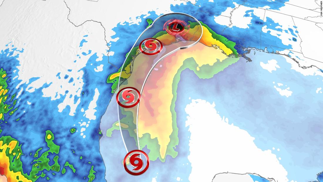
The storm had a high chance of forming over the past 24 hours and with the Hurricane Hunters flying into the storm Sunday morning, it was discovered that this disturbance is now a tropical storm.
A tropical storm warning is in effect from the mouth of the Rio Grande to Port Aransas in Texas. That means winds of at least 39 mph are expected within 36 hours.
Storm surge and tropical storm watches have also been issued, meaning dangerous life-threatening storm surge and tropical-storm-force winds are possible within 48 hours, respectively.
The hurricane center predicts the storm will intensify to 65 mph by Tuesday morning, located at or just offshore from the southern Texas coast.
“With the exact tract of Nicholas still uncertain, we still have a possibility of further strengthening if this storm stays offshore further northward,” says CNN meteorologist Tom Sater. “Nicholas will be entering some of the warmest waters of the Gulf.”
The center of the storm should move through or near Texas on Monday evening for southern Texas and Tuesday for upper portions of the coast.
Heavy rain will be the main threat with a widespread 5 to 10 inches expected for coastal Texas, with localized areas of up to 15 inches.

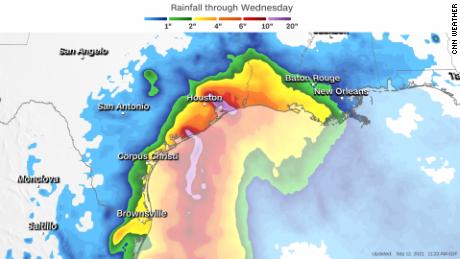
“This rainfall may produce areas of flash, urban, and isolated river flooding including in and around the Houston metro,” says CNN meteorologist Haley Brink.
A flash flood watch is in effect for the coastal region of Texas, including Houston and Corpus Christi, and southwestern Louisiana, which includes Lake Charles.
“Even with an earlier landfall in southern Texas, this storm has the potential for widespread flash flooding. Houston can easily have problems with 4 to 5 inches of rain,” says Sater. “More than that will create bigger problems.”
Storm surge will also be a risk, with 2 to 4 feet forecast from the US-Mexico border through High Island, Texas.
Showers and thunderstorms will begin to move into coastal Texas and Louisiana Sunday afternoon, but storms will remain in the forecast through much of this week.